Audio Tour: Sacramento Pass, Baker & Great Basin National Park
Great Basin National Park derives its name from the Great Basin, the dry and mountainous region between the Sierra Nevada Range in California and the Wasatch Mountains of Utah. Located in White Pine County in east-central Nevada, near the Utah border, the park is notable for its groves of ancient bristlecone pines, the oldest known non-clonal organisms; and for the Lehman Caves at the base of 13,063-foot Wheeler Peak. Topographically, this entire region is known as the Basin and Range Province.
President Warren G. Harding created Lehman Caves National Monument by presidential proclamation in 1922. The monument was incorporated into the National Park Service on October 27, 1986. Adjacent to the park lies the Highland Ridge Wilderness. These two protected areas provide contiguous wildlife habitat and protection to 227.8 square miles of eastern Nevada's basin lands.
Great Basin National Park contains over 40 known caves, filled with unusual cave life and unique features. Some caves contain unique formations such as folia, bulbous stalactites, anthodites, and shields. Some caves contain features that suggest that deep-seated, hydrothermal waters influenced the caves' development. The park has high-elevation vertical shafts and horizontal solution caves that have formed along fracture planes.

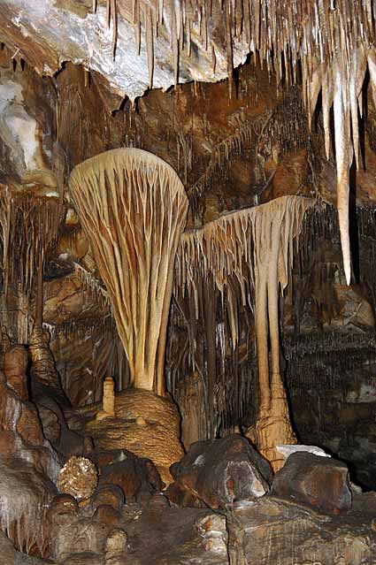
Lehman Caves is a beautiful limestone cave ornately decorated with stalactities, stalagmites, helictities, flowstone, popcorn, and over 300 rare shield formations. Image by Matt Bowers/Third Media.
The caves attract tens of thousands of visitors to eastern Nevada yearly, a trend that began not long after their discovery in the late 1880s. For over 60 years, Lehman Caves National Monument protected these underground wonders, with their unique geology and ecology. And today, they remain protected as part of Great Basin National Park.
Bristlecone pines are the longest-living tree on Earth. Many of Great Basin National Park's bristlecone pines were growing at the time the Pharaohs were still building their pyramids in Egypt!
There are three groves of bristlecone pines in the park. The Wheeler Peak grove, the most accessible in the park, is located on the northeast side of Wheeler Peak. It is unusual in that it grows on a glacial moraine consisting of quartzite boulders. Most groves grow on limestone or dolomite. The northeastern exposure of the Wheeler Peak grove is also unusual as most other groves have a generally southern or western exposure. The Wheeler Peak grove is reached by a 1.5 mile (3 miles round trip) trail from Wheeler Peak Campground. A short self-guided nature trail passes through a portion of the grove. During the summer, the park offers ranger-led interpretive walks in this grove. Check at the visitor center for a schedule.
Rising high above the floor of Lexington Canyon, this imposing natural arch was created by the forces of weather working slowly over a span of centuries. Lexington Arch is unusual in one important respect: it is carved from limestone. Most of the natural arches of the western United States are composed of sandstone. The fact that Lexington Arch is made of limestone leads to speculation that it was once a passage in a cave system. Flowstone, a smooth glossy deposit that forms in caves has been found at the base of the opening, lending support to this theory.
Great Basin National Park is home to the only glacier in Nevada, and one of the southernmost glaciers in the United States. The Wheeler Peak Glacier sits at the base of Wheeler Peak, in a protected cirque around 11,500 feet in elevation. The glacier measures 300 feet long and 400 feet wide. Its exact depth is unknown.
Recognized by the International Dark Sky Association as an International Dark Sky Park in 2016, Great Basin National Park is home to some of the least polluted and clearest night skies in the contiguous United States. The International Dark Sky Association has recognized that Great Basin provides distinguished and significant opportunities to experience dark nights. They protect our pristine nighttime environment for scientific, recreational, and cultural values.
On a clear, summer moonless night, endless spectacles dazzle your eyes. Thousands of stars, bright planets, star clusters, artificial satellites, meteors, the Andromeda Galaxy, and the spectacular arc of the Milky Way are visible by the naked eye from nearly anywhere in the park. Low humidity and minimal light pollution, combined with high elevation, create a unique window to the universe.
During the summer months, roughly between Memorial Day and Labor Day, Great Basin Astronomy Rangers lead programs at the Astronomy Amphitheater every Wednesday, Thursday, and Saturday. Following the Astronomy Festival in September, programs take place on Saturdays until the Astronomy season ends in October.
There is a full moon on Tuesday during the 2025 NCKMS conference. Bring your cameras and warm clothing!
Great Basin National Park has five developed campgrounds with vault toilets, picnic tables, tent pads, and campfire grills. There are no hookups or leveled parking sites. Campsites are limited to eight people, three tents, and two vehicles per site. There are three campgrounds that have ADA accessible sites.
There is one primitive campground along Snake Creek Road. Sites have picnic tables and fire rings. Excellent back country camping opportunities are also available.
The park is located approximately 290 miles north of Las Vegas, but only about 60 miles from Ely. It is most commonly accessed by way of Nevada State Route 488, which is connected to U.S. Routes 6 and 50 by Nevada State Route 487 via the small town of Baker, the closest settlement to the park.
The park has 12 trails ranging from 0.3 miles to 13.1 miles. Trails range from short nature hikes at 6,825 feet (Mountain View Nature Trail), to the Wheeler summit trail starting at 10,160 feet. The Wheeler Summit trail is quite strenuous, and the altitude presents significant hazards for unprepared or inexperienced hikers. Backcountry routes are occasionally maintained throughout the more remote southern portion of the park. A number of these trailheads are accessible by the dirt road that terminates at the primitive Shoshone campground.
If trails are provided, stay on them. Alpine communities are especially fragile and easily damaged. Taking shortcuts creates a complex web of trails and causes erosion. When traveling cross country, avoid damaging vegetation by staying on durable surfaces such as rock or mineral soil.
Elevations in the park range from 6,200 to 13,063 feet, which leads to highly variable weather conditions year round. At elevations of 10,000 feet and higher, snow and/or electrical storms can be life-threatening, and can occur any month of the year. Be prepared for changing conditions.
The Great Basin Visitor Center is located on Nevada State Route 487 in the town of Baker. The Lehman Caves Visitor Center is located on Nevada State Route 488. It is 5.5 miles from Baker, Nevada, 1/2 mile inside the park boundary. Both centers feature exhibits about the park's geology, natural and cultural history, as well as theaters with orientation films. The centers are closed Thanksgiving Day Christmas Day, and New Years Day. Great Basin National Park has between 79,000 and 89,000 visitors in a normal year.
Great Basin National Park is covered by six topo maps in the USGS 7.5 minute series. The Wheeler Peak and Kious Spring maps cover much of the high-elevation backcountry. The Windy Peak map covers a number of the most popular trails and well-developed trails. The Lehman Caves map covers mostly low-elevation areas outside the park. The most remote, least-used backcountry areas are covered by the Minerva Canyon and Arch Canyon maps.
Elevation: 6,200 to 13,063 ft
State: Nevada
District: White Pine County
Coordinates (WGS84): 39.00567; -114.22001
Nearest town: Baker, NV
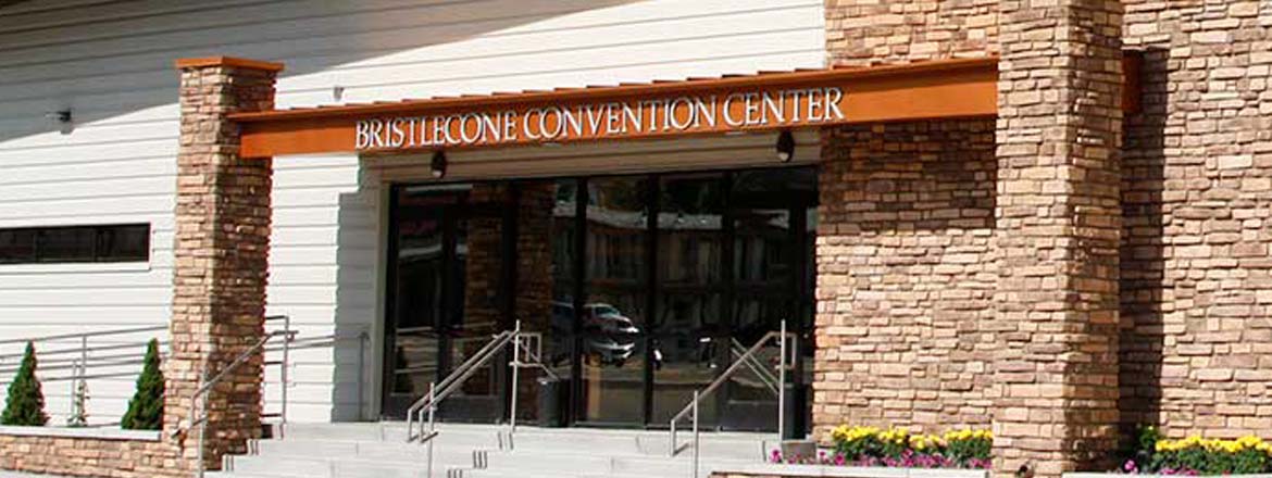
Distance from the convention center: 68 miles

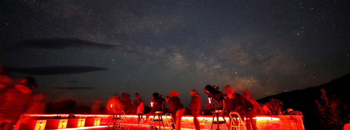
On a clear, moonless night in Great Basin National Park, thousands of stars, five of our solar system's eight planets, star clusters, meteors, man-made satellites, the Andromeda Galaxy, and the Milky Way can be seen with the naked eye. Image by Tom Auchter, NPS.
The official event schedule for the 2025 NCKMS has now been updated. Please check our schedule page or download a PDF to your mobile device.

Since 1941 the NSS has been at the forefront of cave science, conservation, and exploration. Join our 8,500+ member community and come caving.

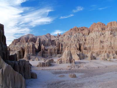
Located between Ely and Las Vegas, Cathedral Gorge State Park features dramatic cave-like slot canyons and cathedral spires that have eroded over millions of years.
![]() Clear, with a low around 14. South southeast wind around 5 mph.
Clear, with a low around 14. South southeast wind around 5 mph.
![]() Sunny. High near 49, with temperatures falling to around 41 in the afternoon. West wind 0 to 5 mph.
Sunny. High near 49, with temperatures falling to around 41 in the afternoon. West wind 0 to 5 mph.
![]() Partly cloudy, with a low around 17. North northwest wind around 5 mph.
Partly cloudy, with a low around 17. North northwest wind around 5 mph.

WCC Ball Cap
Wearing a ball cap? Oh, that's a whole vibe. It's like saying, "I'm strong, but I'm not here for your speleo-approval." It's the kind of quiet power that doesn't scream for attention, but when it walks into the room, everyone knows it's the real deal. No need to flaunt or flex when you've got that kind of effortless strength, right?
Yet, while being grounded and focused on what truly matters, you can still shine at your next grotto meeting by declaring your subtle support of the Western Cave Conservancy!
