An endorheic basin is defined as a region in which the river network is completely isolated from the world ocean: the water flowing in the rivers never reaches the sea. Overexploitation of these finite hyrdologic resources poses significant challenges for cave managers in the arid west. Graphic by Kmusser at Wikimedia Commons, CC BY-SA 3.0
Read MoreThe Great Basin is characterized by numerous arid to semi-arid basins with unconsolidated alluvial aquifers separated by mountain ranges often comprised of carbonate aquifers. Population is concentrated within 100 miles of Salt Lake City and in the Las Vegas area and is growing rapidly. In the less populated areas, ranching, mining, and irrigated farming are the main economies.
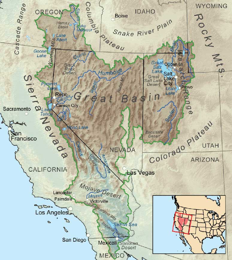
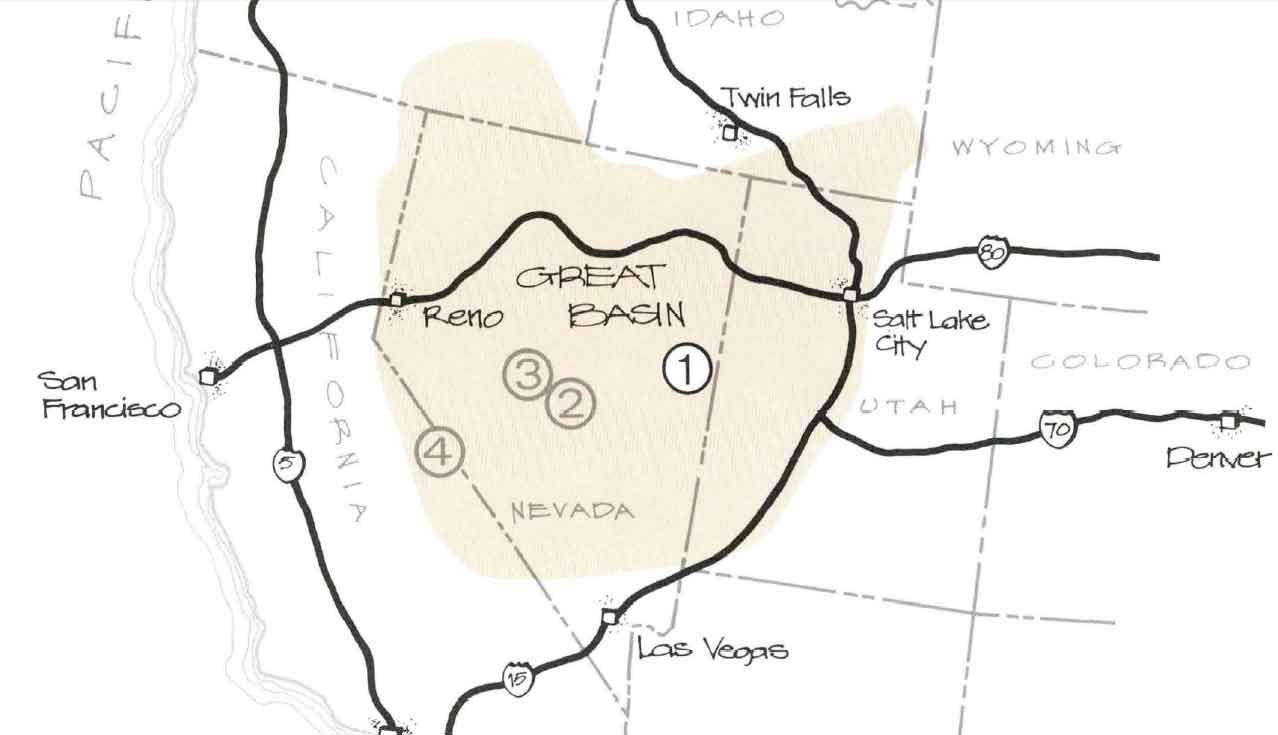
Defining the Great Basin begins with a choice: are you looking at the way the water flows (hydrographic), the way the landscape formed (geologic), or the resident plants and animals (biologic)? Each of these definitions will give you a slightly different geographic boundary of the Great Basin, but the hydrographic definition is the most commonly used.
The Hydrographic Great Basin is a 200,000 square mile area that drains internally. All precipitation in the region evaporates, sinks underground or flows into lakes (mostly saline). Creeks, streams, or rivers find no outlet to either the Gulf of Mexico or the Pacific Ocean. The region is bounded by the Wasatch Mountains to the east, the Sierra Nevada to the west, and the Snake River Plain to the north. The south rim is less distinct. The Great Basin includes most of Nevada, half of Utah, and sections of Idaho, Wyoming, Oregon, and California. The term "Great Basin" is slightly misleading; the region is actually made up of many small basins. The Great Salt Lake, Pyramid Lake, and the Humboldt Sink are a few of the "drains" in the Great Basin.
The Basin and Range region is the product of geological forces stretching the earth's crust, creating many north-south trending mountain ranges. These ranges are separated by flat valleys or basins. These hundreds of ranges make Nevada the most mountainous state in the country.
The Great Basin Desert is defined by plant and animal communities. The climate is affected by the rain shadow of the Sierra Nevada and Cascade Mountains. It is a temperate desert with hot, dry summers and snowy winters. The valleys are dominated by sagebrush and shadescale. The biologic communities on the mountain ranges differ with elevation, and the individual ranges act as islands isolated by seas of desert vegetation. Because the Great Basin exhibits such drastic elevation changes from its valleys to its peaks, the region supports an impressive diversity of species, from those adapted to the desert to those adapted to forest and alpine environments.
Great Basin National Park preserves a small representative piece of this entire region.


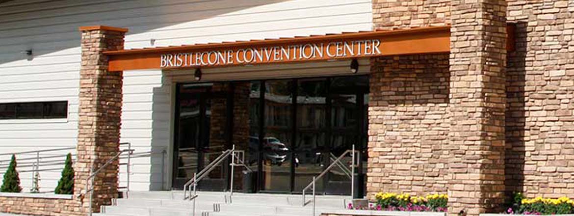
Sitting at Nevada's eastern edge of the "Loneliest Road in America," Ely is a remote mountain town where history, art and outdoor adventure thrive. Ely was founded in the 1870s as a stagecoach stop and trading post called Murray Station, but it would become one of the country's major copper mining regions.
The Nevada Northern Railway arrived in 1906. Now, this well preserved short-line railway draws visitors from all over the world to ride on its queens of steam and historic diesel engines.
![]() Mostly cloudy, with a low around 59. South wind around 5 mph.
Mostly cloudy, with a low around 59. South wind around 5 mph.
![]() Scattered showers and thunderstorms after noon. Partly sunny, with a high near 92. South southwest wind 0 to 5 mph. Chance of precipitation is 50%. New rainfall amounts less than a tenth of an inch possible.
Scattered showers and thunderstorms after noon. Partly sunny, with a high near 92. South southwest wind 0 to 5 mph. Chance of precipitation is 50%. New rainfall amounts less than a tenth of an inch possible.
![]() Scattered showers and thunderstorms before 11pm. Mostly cloudy, with a low around 56. West northwest wind 0 to 5 mph. Chance of precipitation is 50%. New rainfall amounts less than a tenth of an inch possible.
Scattered showers and thunderstorms before 11pm. Mostly cloudy, with a low around 56. West northwest wind 0 to 5 mph. Chance of precipitation is 50%. New rainfall amounts less than a tenth of an inch possible.
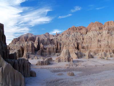
Located between Ely and Las Vegas, Cathedral Gorge State Park features dramatic cave-like slot canyons and cathedral spires that have eroded over millions of years.

WCC Ball Cap
Wearing a ball cap? Oh, that's a whole vibe. It's like saying, "I'm strong, but I'm not here for your speleo-approval." It's the kind of quiet power that doesn't scream for attention, but when it walks into the room, everyone knows it's the real deal. No need to flaunt or flex when you've got that kind of effortless strength, right?
Yet, while being grounded and focused on what truly matters, you can still shine at your next grotto meeting by declaring your subtle support of the Western Cave Conservancy!