Map coordinates:
39.3269, -116.857
Water temperature:
161.6°F
Site ID:
NV-278
Spencer Hot Springs. Image courtesy of the Nevada Commission on Tourism.
The hot springs and wells at Spencer Hot Springs are located mainly in the SE¼ Sec. 13, T17N, R45E (projected). There are also springs to the east of the main spring area (figure), in Sec. 14, T17N, R45½E (Fiero, 1968). Meinzer (1917, p. 50, 91) reported the presence of a travertine terrace nearly 1.6 km long and 0.8 km wide with spring deposits not more than 15 m thick. According to Meinzer (1917), the main spring is 62°C, the north spring is 47°C, and the east spring "normal." Both excavated and developed stock-watering pools on the site are used for bathing by visitors, although no exact temperatures are reported (Williams, 1996, p. 40). Some flow may be from open wells, drilled in the 1940s (U.S. Bureau of Land Management Environmental Assessment NV063-Eao4-59, 2004). Hot water from the main spring is carried by steel pipe to a concrete-lined pool. The temperature of the hottest spring was measured in June 2002 to be 72.1°C (Sanders and Miles, 1974). Wollenberg (1974b) reported that the spring has slightly anomalous radioactivity (19 μR/hr).
Except for Sanders and Miles (1974), who reported that the springs are at the boiling point, the highest temperature (72°C) was recorded by Mariner and others (1974), who suggested that the best estimate of the reservoir temperature is 123°C, using the silica geothermometer. Trexler and others (1980) reported a 72.5°C temperature from the spring. Fiero (1968) believed that the water discharging at Spencer Hot Springs may originate in Monitor Valley to the east after flowing through the intervening Paleozoic carbonate and clastic rocks. The geology of the hot springs and surrounding area is also shown on the 1:62,000 geologic map by McKee (1968). Phillips Petroleum Co. drilled 4 temperature-gradient drill holes in the vicinity of Spencer Hot Springs in 1980 to depths ranging from 29.6 to 64.0m and encountered temperatures no higher than 16.8°C (Sass and others, 1999).
N_Big_Smoky_Valley.pdf Get Topo Map On the Web New Hotspring Search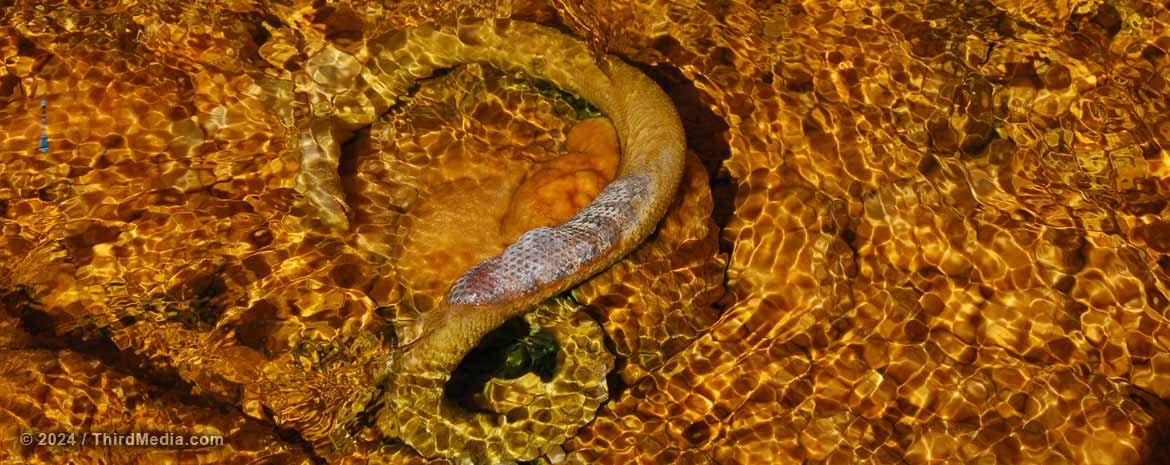
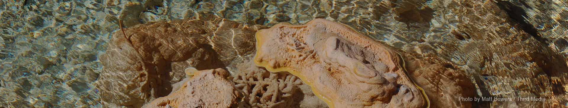
All snakes can swim.... but not in scalding mineral water! This one suffered a rather quick fate and is now being calcified into the streambed. Traveling north towards Cherry Creek, Nevada, along the old shelf road on the west side of Steptoe Valley, Monte Neva Hot Springs bubbles up out of the ground at about 175°F. Image courtesy of Matt Bowers / Third Media.


Cave Gators is the pre-eminent company in the United States specializing in bat-friendly closures on caves and abandoned mines.
No job too tough, no site too remote! We do the jobs that scare away everyone else.
Precipitation patterns are highly variable in Great Basin National Park. The wettest year on record at Lehman Caves was 21.2 inches of precipitation in 1982 and the driest year was 7.4 inches in 1953.
Campfire Coffee Mug
Stay up all night with our personalized ceramic coffee mug.
This 13oz mug is perfect for school, campfire socials, marathon thesis proofreading, and all-night grant-writing sessions.