Map coordinates:
39.0303, -116.666
Water temperature:
140.9°F
Site ID:
nv_dpb
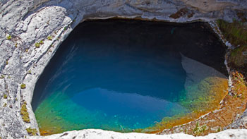
Diana's Punch Bowl & Pott's Ranch. Image courtesy of the Nevada Commission on Tourism.
Dianas Punch Bowl (Dianna's, Devils) (Sec. 22, T14N, R47E) is a cup-shaped depression about 15 m in diameter at the top of a domelike hill of travertine about 183 m in diameter. Warm water in the pool of the bowl is about 9 m below the rim, while the top of the hill is about 23 m above the level of Monitor Valley.
A small warm spring, about 43-49°C in temperature, issues from the southwest corner of the travertine dome (Fiero, 1968). Temperatures up to 59°C have been reported, and the estimated minimum reservoir temperature by several chemical geothermometers is 88-97.7°C (Mariner and others, 1974; Hose and Taylor, 1974).
Very slightly anomalous radioactivity (16 μR/hr) is reported by Wollenberg (1974b). The thermal area lies on a north-trending, concealed fault in the central part of Monitor Valley (Stewart and Carlson, 1974; Fiero, 1968). Spurr (1905, p. 257) describes a report by J.L. Butler that the water level had lowered and water became cooler in the years prior to 1905. Also, he reported that more gas was formerly emitted and occasional flames were seen.
Dianas_Punch_Bowl.pdf Get Topo Map On the Web New Hotspring Search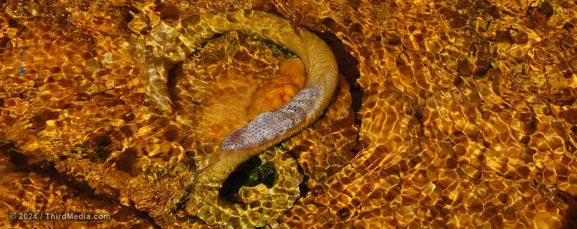
All snakes can swim.... but not in scalding mineral water! This one suffered a rather quick fate and is now being calcified into the streambed. Traveling north towards Cherry Creek, Nevada, along the old shelf road on the west side of Steptoe Valley, Monte Neva Hot Springs bubbles up out of the ground at about 175°F. Image courtesy of Matt Bowers / Third Media.


The Cave Research Foundation is a private, non-profit organization dedicated to:
Facilitating research, management and interpretation of caves and karst resources; Forming partnerships to study, protect and preserve cave resources and karst areas; Promoting the long term conservation of caves and karst ecosystems.
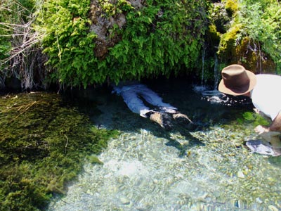
Gandy Warm Springs is a refreshing oasis of tiny waterfalls, pools, caves, and crystal clear streams with water temperatures up to 81°F. Located on the western edge of Snake Valley, near the Nevada border, the springs are at the base of the southern tip of Spring Mountain (also called Gandy Mountain). The spring water that cascades down the slope of Spring Mountain joins a larger spring that emerges from a cave.

h2go Essen Vacuum Food Container
It's a double-wall, stainless steel, 17 oz capacity thermos from h2go®. This thing is more rugged than your cave pack! We've been trying to beat up the manufacturer's sample they sent, but it keeps winning. Hot things stayed hot, cold things stayed cold.
And ours will have the cool NCKMS logo printed on it.