Map coordinates:
39.4603, -114.037
Water temperature:
79.7°F
Site ID:
MI-009
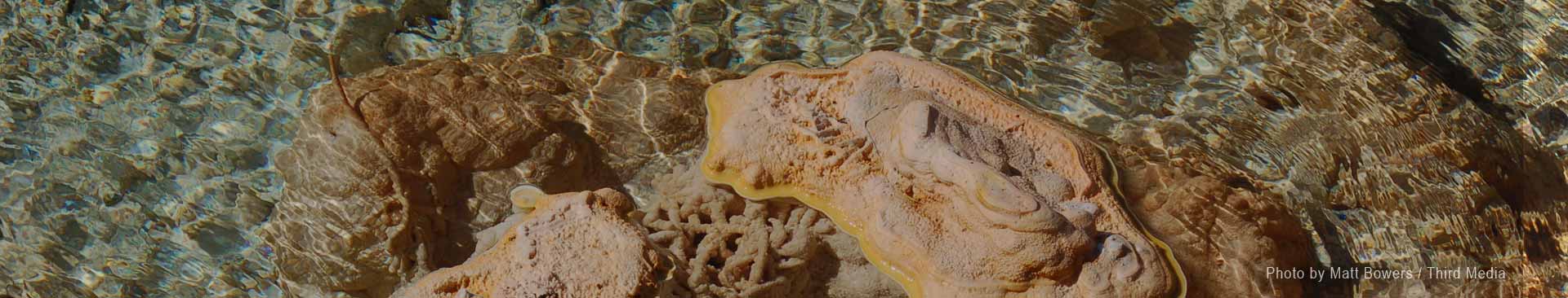
Gandy Warm Springs. Image courtesy of Daniel Veelik, SoCal Grotto.
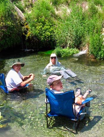
Gandy Warm Springs is a refreshing oasis of tiny waterfalls, pools, caves, and crystal clear streams with water temperatures up to 81°F. Located on the western edge of Snake Valley, near the Nevada border, the springs are at the base of the southern tip of Spring Mountain (also called Gandy Mountain). The spring water that cascades down the slope of Spring Mountain joins a larger spring that emerges from a cave, initiating the eastward-flowing Warm Creek (also called Gandy Creek). Lush green vegetation, including mosses, watercress, and bright green algae, and animals such as aquatic snails (including the endemic springsnail, Pyrgulopsis saxatilis, found only at Gandy) and the native speckled dace wonderfully stand in stark contrast to the surrounding dry yellow grasses and desert shrubs. Gandy is a popular spot for locals who use the area for soaking, swimming, and baptisms.
Given the small size of Spring Mountain, a cluster of hills extending a mile north-to-south and rising just 1000 feet above the surrounding landscape, as well as the noticeably dry climate, one is amazed when considering the voluminous output of Gandy Warm Springs. Every minute, the springs discharge nearly 9000 gallons of water. In other words, Gandy Warm Springs can fill 20 Olympic-sized swimming pools every day.
Gandy_Warm_Springs.pdf Get Topo Map On the Web New Hotspring Search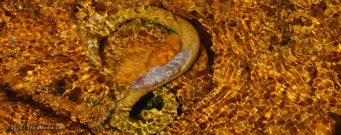
All snakes can swim.... but not in scalding mineral water! This one suffered a rather quick fate and is now being calcified into the streambed. Traveling north towards Cherry Creek, Nevada, along the old shelf road on the west side of Steptoe Valley, Monte Neva Hot Springs bubbles up out of the ground at about 175°F. Image courtesy of Matt Bowers / Third Media.

Great Basin National Park Foundation passionately works to enhance, preserve, and interpret the starry night skies, wide-open scenery, cultural heritage, and diverse native ecosystems of Great Basin National Park.
The Foundation is the official non-profit partner of Great Basin National Park.

Notch Peak, located in West Millard County, Utah, and visible from Great Basin National Park, towers above the desert valleys at 9,725 ft. elevation. This 3,000 ft sheer cliff is one of the tallest limestone cliffs in America.

h2go Essen Vacuum Food Container
It's a double-wall, stainless steel, 17 oz capacity thermos from h2go®. This thing is more rugged than your cave pack! We've been trying to beat up the manufacturer's sample they sent, but it keeps winning. Hot things stayed hot, cold things stayed cold.
And ours will have the cool NCKMS logo printed on it.